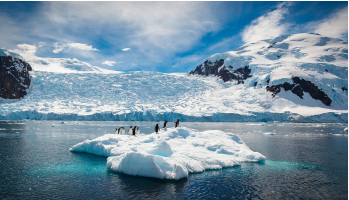
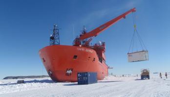
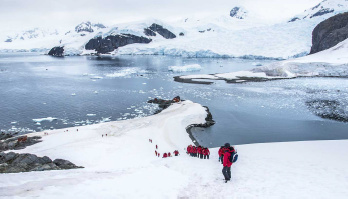
The Southern Ocean

Observing System

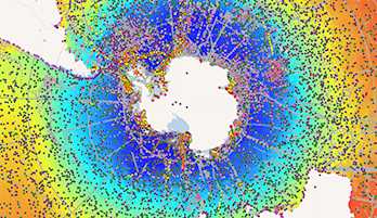
Facilitating and Enhancing Global Southern Ocean Observations

Data Repositories for Physical and Chemical Oceanography

This list includes the major repositories that principally host physical and chemical oceanography data for the Southern Ocean. Much oceanographic data is also held by National Antarctic Data Centers and other multidisciplinary data repositories.

Acronym Full Name Description
AFIN Antarctic Fast Ice Network Password-protected site for fast ice observations
ASPeCt Antarctic Sea Ice Processes and Climate Data from voyages and helicopter flights between 1980 and 2005
CCHDO Clivar and Carbon Hydrographic Data Office Global CTD and hydrographic data
GLOSS Global Sea Level Observation System A global network of coastal sea level monitoring stations
GO-SHIP Global Ocean Ship-Based Hydrographic Investigations Program Links to several data repositories
GOSIC Global Observing Systems Information Center LStores data from the Global Climate Observing System
GRACE Gravity Recovery and Climate Experiment Measurements of the earth's gravity field, including seabed pressure
IBCSO International Bathymetric Chart of the Southern Ocean A digital bathyemtric model, and the underlying data points from which the model was derived.
IODE International Oceanographic Data and Information Exchange A collection of data platforms for oceanographic datasets
MGDS Antarctic and Southern Ocean Data Portal (MGDS) Marine Geoscience data collected by US survey ships
OCADS Ocean Carbon and Acidification Data System Data on ocean acidification and carbon
Ocean-Ops Ocean Ops in-situ Observing Platform Support Center Provides oceanographic and marine observations from ships, buoys, floats, and tide gauges. (Formerly known as JCOMMOPS)
OOI Ocean Observatories Institute The OOI deploys sensors in arrays of moorings, mobile assets, and cabled sensors to measure oceanographic variables from the seafloor to the air-sea interface.
POGO Partnership for Observation of the Global Oceans POGO hosts cruise reports from ships in the European fleet. In time, it is expected to also host cruise reports from US and Australian ships.
PSMSL Permanent Service for Mean Sea Level Tide gauge data
R2R Rolling Deck to Repository Cruise reports from NSF-funded research vessels.
SOCCOM Southern Ocean Carbon and Climate Observations and Modeling SOCCOM aims to use autonomous floats to provide nearly continuous coverage of oceanographic observations in both time and space in the Southern Ocean
USGS United States Geological Survey US agency that provides data on earth, water, and biological sciences.
OceanSITES OceanSITES Long-term deep water reference stations, measuring oceanographic variables from air-sea interactions to 5000 m depth.
Have we missed a key repository for physical and chemical data from the Southern Ocean? Or made a mistake? contact the SOOS data officer.

Data Efforts

Image
Data sharing is at the heart of SOOS. Our aim is to support the development of systems that maximise the discoverability, access and impact of Southern Ocean observations, no matter who collected them, or when, or why.
Image
Image
Explore and download curated and standardised Southern Ocean observational data on an interactive map.
Image
Image
Search the SOOS portal at NASA's Common Metadata Directory (CMR) for worldwide Southern Ocean data.
Image
Image
Find and share upcoming expeditions to the Southern Ocean with international colleagues.
Image
Image
Explore Regional Working Groups that coordinate and implemente the observing system in each region.

Field Coordination

Image
SOOS brings together existing communities and observational efforts to enhance the coordinated collection of observations, through the development of coordination networks and tools. These facilitate collaborative logistics, sharing of resources, alignment of observational priorities, and supporting community effort towards achieving the SOOS mission.

Enhancing Capabilities

Image
SOOS enhances our ability to observe the Southern Ocean integrated, multidisciplinary and sustained way, through support of community-driven working groups and task teaks. These efforts focus on development and implementation of technologies, building networks, improvement of observational design, and development of associated methods.
Image
Image
Explore Capability Working Groups (CWGs), developing and enhancing important Southern Ocean observational capabilities.
Image
Image
Find Task Teams producing specific products, organising events, or solving a particular observing problem.


Latest News & Events

Image

Enhancing observations of the Southern Ocean

Image
SOOS is an international initiative of the Scientific Committee on Antarctic Research (SCAR) and the Scientific Committee on Oceanic Research (SCOR).  SOOS' mission is facilitating the collection and delivery of essential physical, chemical and biological oceanographic observations from the Southern Ocean, to ensure all stakeolders have access to the data required to address key societal issues, such as sea-level rise, heat, freshwater and nutrient transport, and ecosystem responses to changes in the system.
Image
The SOOS 5-year Implementation Plan defines the actions of the SOOS community for the period 2021-2025.
Image
The Southern Ocean community has identified 5 scientific challenges that are used to focus our observational priorities.
Image
SOOS has a simple governance structure, with close connections to external scientific and coordination bodies.
Image
The International Project Office (IPO) is the central hub of the SOOS effort, click above for details on how to contact the IPO.

Sponsors

Image

Stay up to date. Subscribe to our newsletter