Censusing Animal Populations from Space (CAPS)
Capability Working Group

Developing a cost-effective, remote sensing-based method for monitoring animal populations from space
The remote, harsh and logistically challenging nature of the Southern Ocean environment means that monitoring and understanding the state and variability of the Southern Ocean ecosystems and biodiversity (SOOS key theme ST4) is difficult by traditional survey methods. The Censusing Animal Populations from Space (CAPS) Capability Working Group aims to develop cost-effective monitoring approaches using satellite remote sensing to ascertain accurate estimates of population status and trends of significant predators in order to assess changes in Southern Ocean ecosystems.
Despite being the greatest consumers of krill in the Southern Ocean, our understanding of the status and trends in pack-ice seal populations and their relationship with key habitat characteristics, such as sea-ice, currently represents a major knowledge gap. Until now, it has been too logistically challenging and expensive to conduct regular pack-ice seal surveys at a spatial scale sufficient to assess their regional-scale abundance and distribution. Remote sensing based methods provide a cost-effective approach to monitoring seals that will enable these otherwise elusive data be made available.
The work of the SOOS CAPS Capability Working Group will be to develop methods and coordinate approaches to better understanding the populations and population trends of Antarctic pack-ice seals, across the continent and in specific important locations such as Marine Protected Areas. We will also look to expand the work of the group to coordinate satellite remote sensing efforts for other species of marine predators in the Southern Ocean.

The full terms of references for this working group can be found here.
-
Coordinate research and development into the use of satellite remote sensing with the ultimate aims of a better understanding of populations and population trajectories of ice seals in the Southern Ocean (SO).
-
Continue with satellite tasking
-
Optimize machine learning algorithms
-
Finalize habitat models.
-
-
Develop robust remote sensing methods for spatial management and monitoring of marine predators in the SO. This includes a focus on critical areas such as MPAs, ASPA/ASMA and proposed areas of protection.
-
Expand the work of CAPS to other SO species, such as whales, penguins other pinnipeds and flying seabirds, where there is an interest in satellite monitor of predators and a need to coordinate efforts.
-
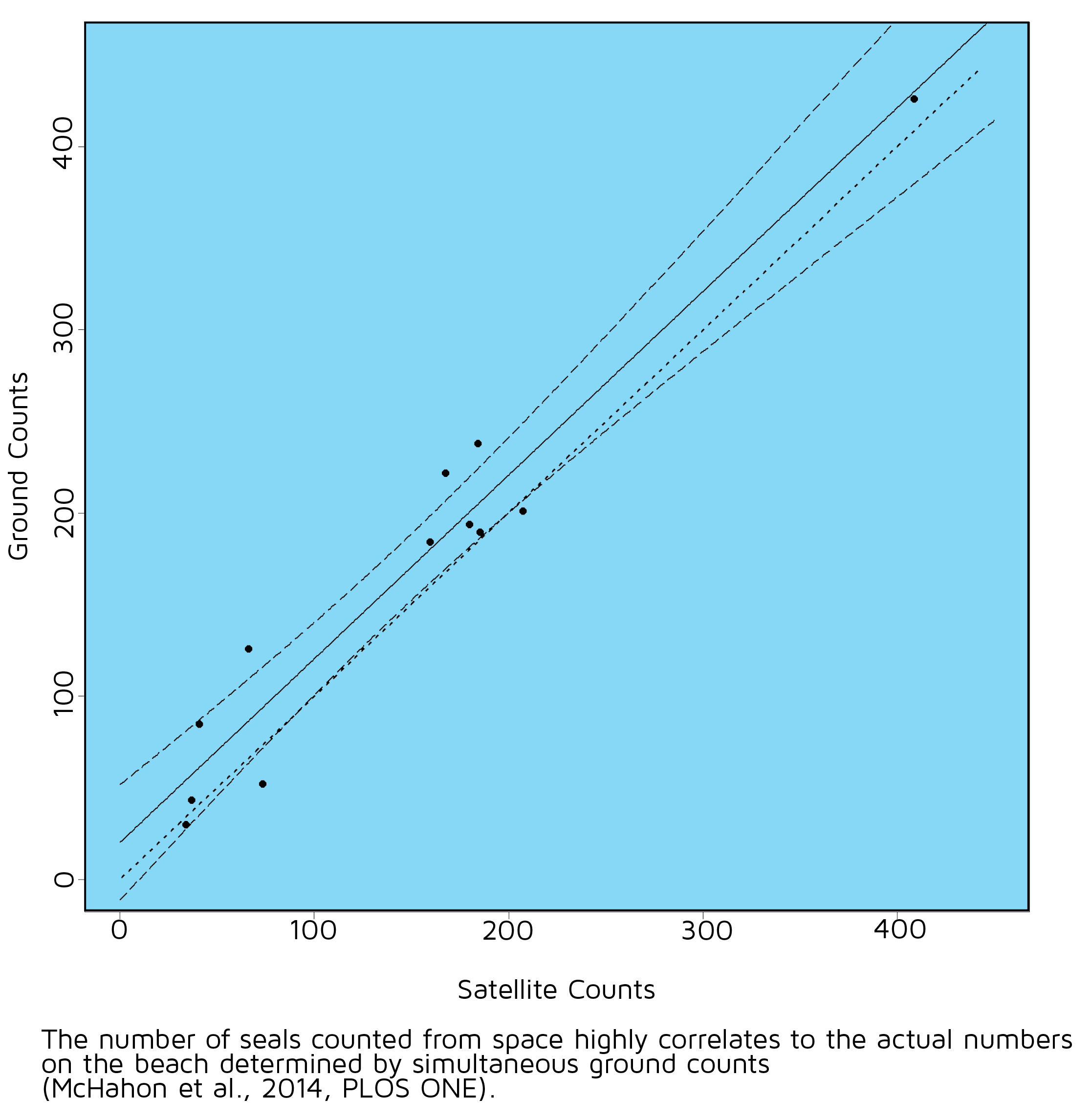
Develop and coordinate the ground validation of satellite observations including forging stronger connections with land based monitoring programs.
-
Hold annual meetings of the working group at international conferences and seek links and synergies with other SOOS programs of relevance.


