Seabed 2030 – mapping the world ocean floor
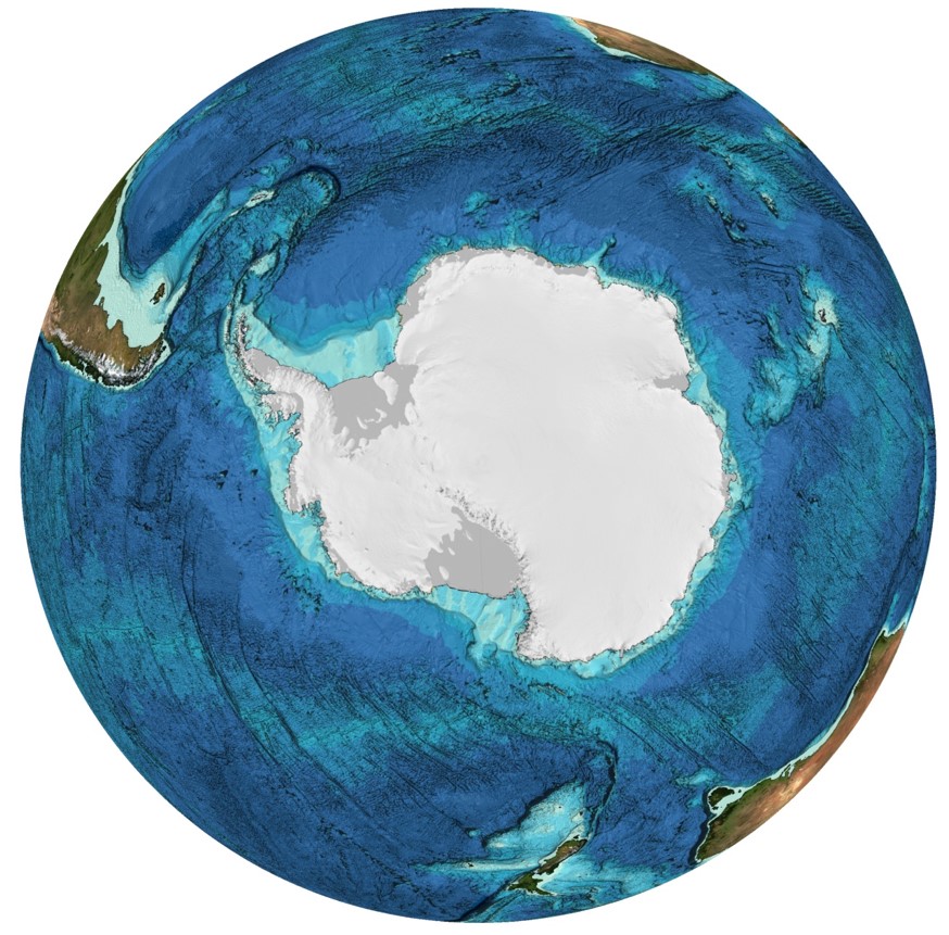
Seabed 2030 is an ambitious, collaborative global project that aims to bring together all available bathymetric data to produce the definitive map of the world ocean floor by 2030 and make it available to all. Bathymetry data is important observational information that is essential for understanding a variety of fundamental marine processes, including ocean circulation, benthic habitat distributions, weather systems, tides, sediment transport, tsunami wave propagation, and climate change. This new depiction of ocean floor topography will also help identify underwater hazards and inform sustainable marine resource management and infrastructure development.
Despite its importance for understanding processes at and beneath the seafloor, and throughout the water column, only a small portion of the global seafloor has been mapped with direct measurement.
Seabed 2030 is a collaboration between the Nippon Foundation of Japan and the General Bathymetric Chart of the Oceans (GEBCO). The project was launched at the United Nations (UN) Ocean Conference in June 2017 and is aligned with the UN's Sustainable Development Goal #14 to conserve and sustainably use the oceans, seas and marine resources. The project aspires to empower the world to make policy decisions, sustainably use the ocean, and undertake scientific research that is informed by a detailed understanding of the ocean floor.
Seabed 2030 relies heavily on coordination, capacity building and partnerships at local, regional, and global scales. It aims to incorporate all currently available data into the GEBCO seafloor map, use existing data not in publicly available databases and identify areas for which no data exist to inspire and inform future mapping missions. In building the new ocean map, Seabed 2030 will apply best practice in data standards and documentation. It is also envisioned that use of emerging technology in ocean mapping, including unmanned surface vehicles and automated data processing techniques, will be critical for this initiative.
Central to the Seabed 2030 strategy are the four Regional Data Assembly and Coordination Centres (RDACCs) and the Global Data Assembly and Coordination Centre. The Regional Centres are responsible for championing mapping activities, assembling and compiling bathymetric information into regional products and collaborating with existing mapping initiatives within their regions. The Global Centre is responsible for producing and delivering global GEBCO products. Most importantly, the centres will work to foster collaboration and avoid duplication so that we use our limited global mapping resources most efficiently.
The Seabed 2030 project organisation originates from the GEBCO Regional Mapping Projects, including the International Bathymetric Chart of the Southern Ocean (IBCSO) which forms the Southern Ocean RDACC hosted at the Alfred Wegener Institute in Germany. Bathymetric data for the Southern Ocean region (extended to 50o S) is currently being compiled for IBCSO v2 and has been submitted to the Global Centre for inclusion in GEBCO 2020.
Improved bathymetry data availability is critical for the SOOS community. For example, accurate bathymetry data from the continental shelf and within iceshelf cavities is required to constrain ocean and ice-sheet models.
Data discovery is a fundamental pillar of the Seabed 2030 project. The Southern Ocean scientific community has and will continue to play an important role in data sharing. Large amounts of bathymetric data has already been included in the latest regional and global data compilations, however, there is still existing bathymetric data, not already found in national archives, waiting to be unearthed. Such acoustic data may have been gathered in conjunction with ocean science research cruises, or by industry interests willing to now contribute it for the greater good. It also includes data collected by new platforms such as automated underwater vehicles (AUVs). The SOOS community can help inform where this data exists and where future mapping efforts should be focused.

Please visit Seabed 2030 for more information. If you have valuable bathymetry data to contribute, please contact the
Dr Jodie Smith
Geoscience Australia
SCAR International Bathymetric Chart of the Southern Ocean (IBCSO) Geosciences Expert Group
Seabed 2030 Regional Mapping Committee – Southern Ocean (RMC-SO)
 |
 |
 |
 |


