ROBOTICA Updated (Research of Ocean-ice BOundary InTeraction and Change around Antarctica)

Image

Shigeru Aoki1, Takeshi Tamura2 and Team ROBOTICA
1Institute of Low Temperature Science, Hokkaido University, Japan
2National Institute of Polar Research, Japan

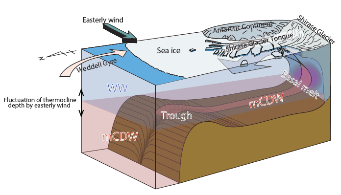
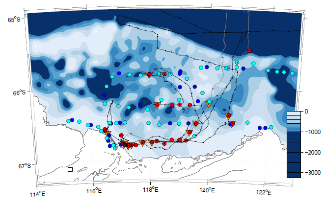
In 2016, SOOS endorsed the national Japanese research project ROBOTICA, which focuses on the continental margin off East Antarctica, looking at the potential impact of unstable under-ice topography on global sea level rise and the effect of polynyas on bottom water formation. The six-year (2016-2022) project, ROBOTICA, focuses on the three distinctive areas in East Antarctica; in the Lützow-Holm Bay adjacent to Cosmonaut Sea, in front of Totten Glacier off Sabrina Coast, and off Cape Darnley of Mac. Robertson Land. The project aims to collect observations to further enhance our understanding of the interactions between ocean and land ice/sea ice. Through a multi-disciplinary approach development of new observation techniques, the project is enhancing the understanding of ocean-ice behaviours.

In the Lützow-Holm Bay region, which has experienced potential ice mass gain in recent years, the land-fast sea ice has entered an "unstable period" from the latter half of the 2010s (Aoki, 2017). The Icebreaker, Shirase, was successful in collecting large-scale ocean observations for the first time in the history of the Japanese Antarctic Research Expedition. It was revealed that warm deep-water flows into the bay, resulting in high basal melting of the Shirase Glacier tongue (Figure 1; Hirano et al., 2020). Melt rates of the Shirase Glacier, estimated from ice radar measurement, are one of the highest in the East Antarctica, and are compatible with the values derived from numerical experiments, together with its seasonal variation. In addition, the Langhovde Glacier, which is located on the eastern side of the bay, was successfully observed above and under the ice shelf in summer, and the possibility of basal melting and outflow of melt water was found. It was also revealed that changes in tide control the horizontal and vertical fluctuations of glaciers (Minowa et al., 2019).
Figure 1: Schematics of water circulation in Lützow-Holm Bay, East Antarctica.
Figure 2: Ship track and observation sites off Totten Glacier, Sabrina Coast.
In the Cape Darnley Polynya, a key origin of Antarctic Bottom Water, a new tethered profiler system was successfully moored for twelve months, giving observations of seasonal fluctuations in salinity, temperature and density stratification, including the seasonal development of salinity in the polynya. The time to reach the salt level required for bottom water formation was consistent with the timing of bottom water formation seen in previous observations (Aoki et al., 2020). Comparisons with increases in salt content due to sea-ice production obtained by satellites (Tamura et al., 2016) suggests that the change in salt content may be affected by the exchange of water mass across the continental slope.
 
In front of the Totten Glacier, where present and future mass loss is of wide concern, large-scale observations were conducted in 2019/20 by the icebreaker, Shirase (Figure 2). After struggling with severe sea-ice condition, we obtained a wide area of seafloor topography with a narrow multi-beam echo sounder. Now in the fifth year of the six-year period, the recovery of the mooring system is pending due to COVID-19, with the retrieving operation planned for 2022.

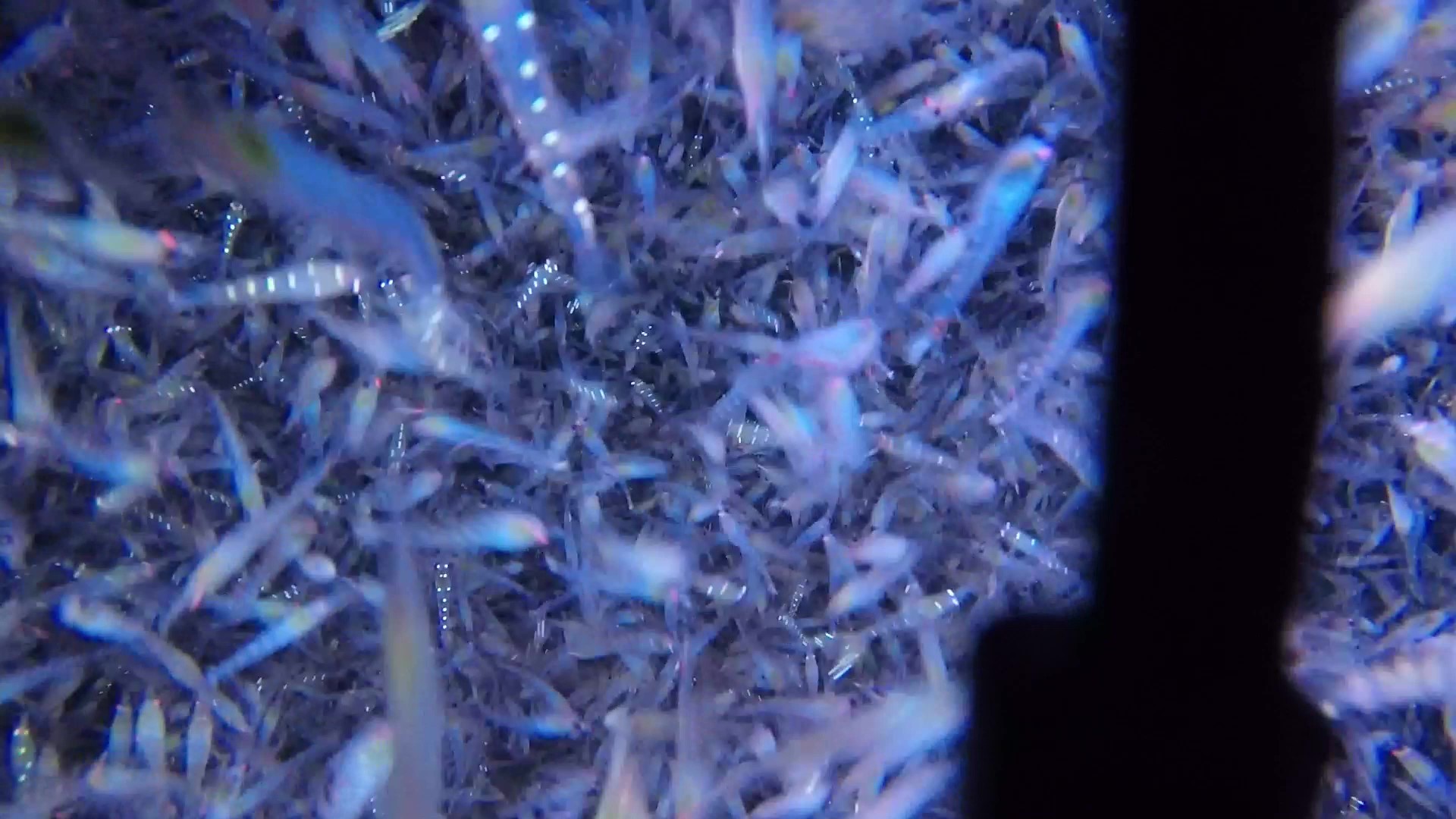
By operating a Remotely Operated Vehicle (ROV), an unmanned marine observation platform designed in this project, we found a large aggregation krill in Lützow-Holm Bay (Figure 3). The platform laid the foundation for the application of multidisciplinary observations in the future. Joint observations with seal biologging are producing valuable information on oceanic physical structure. While promoting the data disclosure through ADS, we would like to contribute to the creation of a new picture of ocean-ice system of East Antarctica.

Figure 3: Krill aggregation in Lützow-Holm Bay, taken by ROV around 100m depth.